Stage 6: Badia Prataglia to La Verna

Badia Prataglia to La Verna

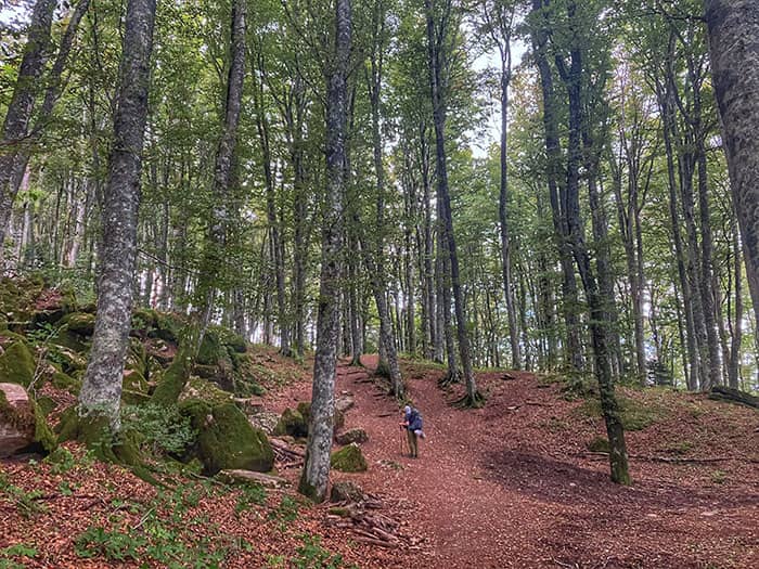
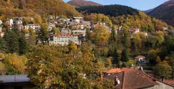
Today’s path takes pilgrims through rocky mountain climbs, thick fern forests, and powerful vistas before entering the sacred and mystical forest, where ancient trees tower over you like a cathedral, as you approach the Sanctuary of La Verna. Whether you choose the Rimbocchi or Rifugio Casa Santicchio route, the views leave you in awe.

This stage is the most challenging so far. Leave Badia Prataglia early to arrive before the 15:00 procession at La Verna Sanctuary. Or break the stage up into two days by staying overnight at the farmstay Santicchio.

Ancient trees of the Sacred Forest tower over you like a cathedral, as you approach the Sanctuary of La Verna.

Stage 5: Camaldoli to Badia Prataglia

GPX Maps

We strongly recommend pilgrims use offline GPX to navigate the trails.

Quick Glance

Start:
Badia Prataglia, Santa Maria Assunta Parish Church
Finish:
Santuario della Verna
Distance:
17.8 km 
(11.1 mi)
Travel Time:
8 hours
Total Ascent:
1182 meters
Total Descent:
959 meters
Trail Surface:
Rocky mountain, forest trail, Sacred Forest
Trail Signs:
Occasional, with directional signs
Water Sources:
Fountain in Rimbocchi
Food:
There is no food on the trail. It’s possible to stop for a snack or water at Rifugio Casa Santicchio about halfway. Or just stay overnight! The Monastery at La Verna features a coffee shop and serves dinner to pilgrims who sleep there.
Navigation Notes:
Challenging walk. Pilgrims can stop half-way at Rifugio Casa Santicchio, or take alternative route to Biforco.

Preparation

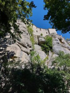
Breathtaking view of the cliff of La Verna. Pilgrims will see this right when walking out of the Sacred Forest. Photo by Simone

Up, down, and back up again. Stage 6 of the Via di Francesco starts with a rocky climb up Poggio della Cesta, and then gently guides pilgrims past Frassineta church and mountain farmstay Rifugio Casa Santicchio down to the town of Rimbocchi. Pilgrims can refill water here, and then start the forest climb to the Sanctuary of La Verna. The sacred forest embraces pilgrims unlike any other forest passage thus far. And finally, you will arrive at the most beloved place of St Francis, the Sanctuary of La Verna.

Stage 6 Highlights

Difficulty

Difficult. Today is the most challenging of the first six stages. Expect hard walks for around 8 hours or more.

Microclimate

Today’s walk climbs to mountain peaks, then to valley floors, and back up again. Wear easily changeable layers to manage climate and humidity changes.

Navigation

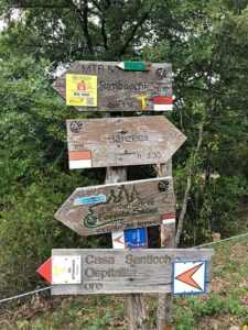
Pilgrims will meet several alternative routes and crossroads into La Verna. Plan ahead which route you will take, and then follow the signs and GPX.

Food

There is no food on the trail. It’s possible to stop for a snack or water at Rifugio Casa Santicchio about halfway. Or just stay overnight! The Monastery at La Verna features a coffee shop and serves dinner to pilgrims who sleep there.

Step-By-Step Instructions & Itinerary

Santuario della Verna
Santuario della Verna on a cliff

Step-By-Step: Stage 6

Strong Recommendation: Use the official GPX files in addition to these instructions to not miss any turns. As signs are sparse, it can be easy to miss one.

Trail signs on the path
Official Route: Pilgrims will walk by Rifugio Casa Santicchio.
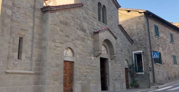
  1. From Badia Prataglia’s Romanesque church, Santa Maria Assunta, take the trail 073.
  2. Descend until reaching the altitude of 770 meters while crossing the Archiano stream, then climb up to the Poggio della Cesta at an elevation of 1100m.
  3. Follow the ridge, more or less at the same elevation, until you reach Quattro vie, an irregular clearing approximately 3.5 km from Badia Prataglia.
  4. Continue for another kilometer until you reach the small village of Frassineta (at 880m).
  5. Take path 070, which is north of the church in Frassineta, towards Rimbocchi.
  6. Climb up to an elevation of 975m, then descend to 700m at Poggio alla Forca (total distance of approximately 1.5 km).
  7. Follow the signs to turn off towards the nearby Rifugio Casa Santicchio.
  8. Descend steeply for another kilometer and a half until you reach Rimbocchi (at 540m).
  9. Follow the paved road towards La Verna from Rimbocchi.
  10. Less than 2 kilometers later, turn right onto the dirt road – known as a carrareccia or ‘wagon road’ – toward Podere Casalino Farmstay (at km 1.5).
  11. Cross the Corsalone stream on a recent viaduct and head toward Podere Casalino (at 765m) on path 54, which meanders pleasantly through the steep walls of the surrounding hills.
  12. From the clearing of Podere Casalino, the trail continues uphill, almost like a rudimentary staircase. After a kilometer and a half, you will reach an altitude of about 1000 meters at the intersection with trail 53.
  13. Take path 53, which leads to Sasso Cavallino below La Verna, and guides the route through the tangle of boulders that have fallen from Mount Penna.
  14. From Sasso Cavallino, the trail 53 climbs up and ends at the road of Beccia. From there, with a final climb, you will reach the Sanctuary.

Alternative Routes

Rimbocchi

The official route walks pilgrims by Rifugio Casa Santicchio. Some guidebooks to go downhill directly into Rimbocchi. This route may save some energy as you won’t be hiking up. Consult other guidebooks for this route.

Biforco

Some guidebooks guide pilgrims to accommodations in Biforco to split up this stage. Consult other guidebooks for this route.

Overnight at Rifugio Casa Santicchio

This rifugio is a gem of the Francesco. Standing high and remote, Rifugio Casa Santicchio lets pilgrims rest in seclusion and peace. The restored farmhouse features comfortable rooms, and most of all, quiet. Stopping overnight makes the remaining kilometers to La Verna much more relaxed, and gives pilgrims ease to arrive at the sanctuary before the procession starts.

Rifugio Casa Santicchio - Building Cover
Breakup the day and rest at Rifugio Casa Santicchio
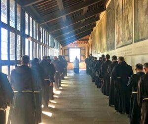
Pocession at La Verna. Photo by Santuario della Verna

About the Sanctuary of La Verna

La Verna is one of the most significant centers for Franciscan spirituality, and is visited by pilgrims and tourists alike. One of the highlights of the sanctuary is the Chapel of the Stigmata, which is built on the spot where St Francis is said to have received the wounds of Christ. La Verna is also renowned for its natural beauty.

Pilgrims can join twice daily the procession of Friars from Santa Maria church to the Chapel of the Stigmata. Pilgrims on foot can most easily attend the 15:00 procession. Pilgrims who wish to visit the cafe or stay overnight can use this map of the monastery to find the check-in.

Pilgrims in front of the Basilica at La Verna
Services in La Verna
  • Cafe
  • Bookstore
  • Lodging
Services in Chiusi della Verna

La Verna Sanctuary sits 2 km from the village Chiusi della Verna.

What’s Next: Umbria & Assisi

From La Verna, pilgrims pass into the Umbria region on their way to Assisi. See information for stages after La Verna.

Some pilgrims may choose to return to Florence. See our guide to return to Florence from La Verna.

Accommodations

Pilgrim Ospitale Member / Pilgrims' Discount
Breakfast Included
Dinner Available
Good for Groups
Rimbocchi, 
8.83 km from the end of stage
€50-€70
Biforco, 
7.3 km from the end of stage
€15-€25
Biforco, 
7.3 km from the end of stage
€45-€70
Chiusi della Verna, 
0 km from the end of stage
€59-€68
Chiusi della Verna, 
1.7 km from the end of stage
€80
Chiusi della Verna, 
1.7 km from the end of stage
€50
Chiusi della Verna, 
2 km from the end of stage
€55-€90

Other Stages

Distance: 18.9 km
Travel Time: 6 hours
Elevation: 495 meters
Trail Surface: Concrete sidewalk, gravel trail, some concrete road
Distance: 18.6 km
Travel Time: 6 hours
Elevation: 1138 meters
Trail Surface: Two-thirds concrete road, then woodsy trails
Distance: 18 km
Travel Time: 6 hours
Elevation: 462 meters
Trail Surface: Forest trail, loose big rocks on descending path. Need poles.
Distance: 17.5 km
Travel Time: 6 hours
Elevation: 910 meters
Trail Surface: Forest trail, Casentinesi Forest, Uphill
Distance: 8.3 km
Travel Time: 3.5 hours
Elevation: 515 meters
Trail Surface: Forest trail, fern forest, Casentinesi National Park

Printable Wakling Guide

Get printable Walking Guide for Stages 1-6 as a part of the Pilgrim Essentials Kit.

Enter your email to receive the free kit, including Walking Guide, Accommodations Guide, pilgrim Quick Start email series, and more.