Stage 5: Camaldoli to Badia Prataglia

Camaldoli to Badia Prataglia

Today’s walk is short, but steep. Be ready for a strenuous climb from Camaldoli back into the heights of the forest. The trail then becomes a leisurely hike into the quiet resort town Badia Prataglia.

For pilgrims looking to get a jumpstart on Stage 6, continue on to Rifugio Casa Santicchio, a remote farmhouse just a few hours from the Sanctuary at La Verna. An alternate route takes pilgrims by hermitage Eremo di Camaldol on the way to Badia Prataglia.

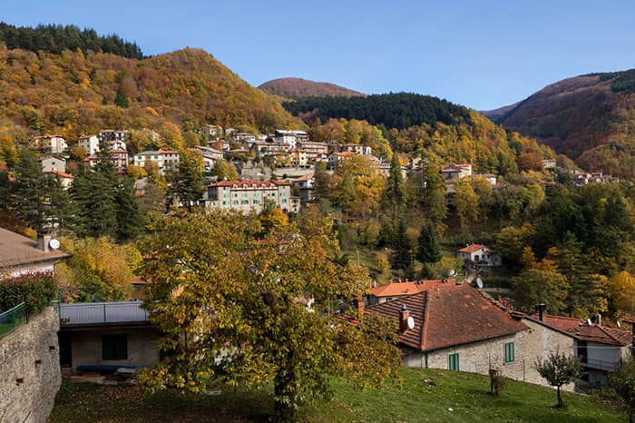
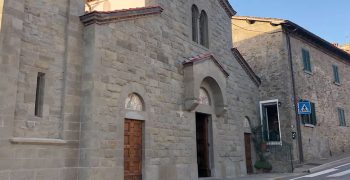
Beautiful view of Badia Prataglia. Photo by Giordano Giacomini

Stage 4: Stia to Camaldoli

Stage 6: Badia Prataglia to La Verna

GPX Maps

We strongly recommend pilgrims use offline GPX to navigate the trails.

Quick Glance

Start:
Monastery of Camaldoli
Finish:
Badia Prataglia, Santa Maria Assunta parish church
Distance:
8.3 km 
(5.2 mi)
Travel Time:
3.5 hours
Total Ascent:
515 meters
Total Descent:
519 meters
Trail Surface:
Forest trail, fern forest, Casentinesi National Park
Trail Signs:
Rare
Water Sources:
None on trail
Food:
There are no eateries between Camaldoli and Badia Prataglia. But the walk is short. And there are several restaurants to visit in Badia Prataglia.
Navigation Notes:
Today’s walk is short. Pilgrims can consider visiting Sacro Eremo di Camaldoli or walk directly to Badia Prataglia.

Preparation

If there is an active rest day on the Via di Francesco, this is it. Start with a steep climb from Camaldoli. Then, walk easy on the flattened forest path into Badia Prataglia. Walk early and you’ll arrive before noon, just in time for lunch and nearly a half-day rest.

Stage 5 Highlights
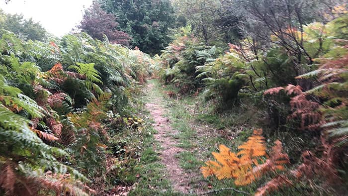
Fern Forest at the top of the mountain

Stamps

You can get a pilgrim stamp from Monastero di Camaldoli, and also places where you stay overnight.

Difficulty

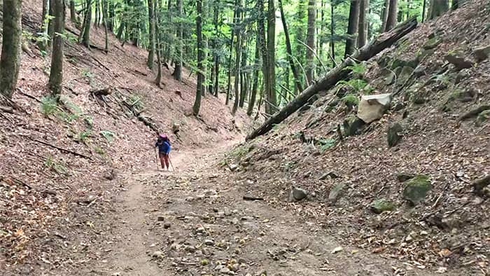
The initial climb from Camaldoli is very sharp and tiresome. Recommend hiking pole for the initial stage. After that, the trail is relaxing and calm.

Microclimate

Same forest climate continues. Pilgrims will be on the top of mountain where fern forests grow.

Navigation

Trail markers are few and far between. Keep checking the GPX to stay on track.

Food

There are no eateries between Camaldoli and Badia Prataglia. But the walk is short. And there are several restaurants to visit in Badia Prataglia.

Step-By-Step Instructions & Itinerary

Steep mountain path at the initial stage to Badia Prataglia. Recommend using hiking poles.

Step-By-Step: Stage 5

Strong Recommendation: Use the official GPX files in addition to these instructions to not miss any turns. As signs are sparse, it can be easy to miss one.

For this trail, pilgrims have 2 options:

OPTION 1 – Straight to Badia Prataglia
  1. Start at the Monastery of Camaldoli.
  2. Follow trail 72 and cross the bridge.
    Note: If you spot a closed trail due to slippery rocks, continue on the street for 300 m. You will notice an alternate path that points to Rifugio Cotozzo. This alternate path is steep. Must use hiking poles.
  3. Continue for about 1 km through a forest of fir trees to reach 1100 m altitude.
  4. Keep climbing up to 1250 m altitude.
  5. Continue with ups and downs of about 100 meters, until you reach the village of Badia Prataglia at 835 m altitude.
OPTION 2 – Visit Eremo di Camaldoli on the way

Take in the opportunity to visit the Hermitage, enjoy the panoramic views towards Lake Ridracoli and towards Romagna to the sea, and to cross impressive fir and beech forests.

  1. Take trail 68 next to the post office to reach the Hermitage of Camaldoli (1103 m altitude) which is 3 km away.
  2. From the Hermitage, take trail 74 to reach Prato alla Penna (1248 m altitude) which is about 1.3 km away.
  3. Follow the ridge for about 1.9 km on CT 00 GEA and reach Passo dei Fangacci (1228 m altitude).
  4. From Passo dei Fangacci, descend for about 3 km to reach Badia Prataglia at 835 m altitude.

Alternative Routes

Walk to Rifugio Casa Santicchio

Start early to arrive in Badia Prataglia before noon. Then follow Stage 6’s GPX to the remote farmhouse, about a third of the way to La Verna. Make sure you call ahead and reserve dinner.

Rifugio Cotozzo
Rifugio Cotozzo
On the Trail

Rifugio Cotozzo
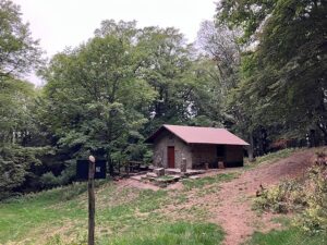
At the top of the climb out of Camaldoli, pilgrims will discover Rifugio Cotozzo near Camaldoli. The small cabin has a fireplace, and can be a nice seat to wait out any bad weather.

About Badia Prataglia

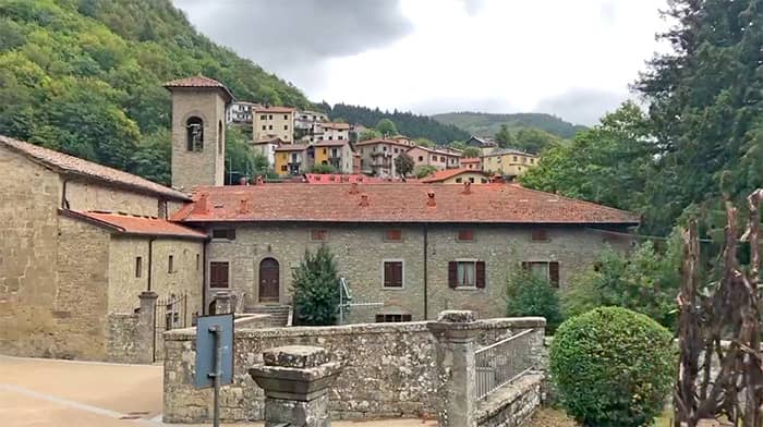
Badia Prataglia hosts vacation homes and hotels serving tourists of the Foreste Casentinesi National Park, one of the most untouched forests in all of Italy. The town was founded in the 11th century around the Abbey of Santa Maria Assunta and St Bartholomew. The Badia Prataglia abbey declined against the rising popularity of the Camaldoli abbey, eventually falling into disrepair. Today the parish church stands in its place.

Santa Maria Assunta is right on the Way of St Francis trail in Badia Prataglia.

What’s Next: Stage 6

Tomorrow’s stage offers some of the most magical forest groves and sites of the first 6 stages. Our recommendation: Take it slow, and enjoy the walk. It’s also a good idea to buy snacks in Badia Prataglia for the walk to La Verna.

Stage 6: Badia Prataglia to La Verna

Accommodations

Pilgrim Ospitale Member / Pilgrims' Discount
Breakfast Included
Dinner Available
Good for Groups
Camaldoli, 
6.2 km from the end of stage
€0
Camaldoli, 
4.07 km from the end of stage
€20
Badia Prataglia, 
0 km from the end of stage
€49-€67
Badia prataglia , 
0 km from the end of stage
€30
Badia Prataglia, 
0 km from the end of stage
€105
Badia Prataglia, 
4.1 km from the end of stage
€30

Other Stages

Distance: 18.9 km
Travel Time: 6 hours
Elevation: 495 meters
Trail Surface: Concrete sidewalk, gravel trail, some concrete road
Distance: 18.6 km
Travel Time: 6 hours
Elevation: 1138 meters
Trail Surface: Two-thirds concrete road, then woodsy trails
Distance: 18 km
Travel Time: 6 hours
Elevation: 462 meters
Trail Surface: Forest trail, loose big rocks on descending path. Need poles.
Distance: 17.5 km
Travel Time: 6 hours
Elevation: 910 meters
Trail Surface: Forest trail, Casentinesi Forest, Uphill
Distance: 17.8 km
Travel Time: 8 hours
Elevation: 1182 meters
Trail Surface: Rocky mountain, forest trail, Sacred Forest

Printable Wakling Guide

Get printable Walking Guide for Stages 1-6 as a part of the Pilgrim Essentials Kit.

Enter your email to receive the free kit, including Walking Guide, Accommodations Guide, pilgrim Quick Start email series, and more.